Rivers are among the earth’s most ancient and most consequential geographical features — the arteries of civilisation that have determined where humans settled, how empires rose and fell, which agricultural traditions developed, and how entire cultures shaped their relationship with the natural world. From the Nile’s annual floods that built ancient Egypt’s legendary agricultural abundance to the Amazon’s incomprehensible biodiversity that continues to astound scientists, the world’s great rivers are simultaneously physical landmarks, ecological systems, cultural identities, and the perpetual subjects of geographical debate and scientific measurement.
The question of which river is the longest has been contested by scientists, geographers, and national governments for centuries — and the debate remains genuinely unresolved in several cases because river length measurement depends on choices that are not uniformly agreed upon. Where exactly does a river begin? At the furthest source of its most distant tributary, or at the confluence of its main channel’s most accepted headwaters? Where does it end — at the last point where its main channel enters the sea, or at the outer edge of its delta? Different measurement methodologies produce different results, and in the case of the Nile and Amazon — the world’s two longest rivers — the margin between first and second place is so narrow that different credible studies reach opposite conclusions.
This guide presents the ten longest rivers in the world with the most widely accepted length measurements, the countries they traverse, the civilisations they sustained, and the geographical and ecological significance that makes each one extraordinary beyond its mere dimensions.
| Rank | River | Length (km) | Length (miles) | Continent | Countries |
| 1 | Nile | 6,650 km | 4,130 miles | Africa | Uganda, Sudan, Egypt + |
| 2 | Amazon | 6,400 km | 3,976 miles | South America | Peru, Colombia, Brazil |
| 3 | Yangtze | 6,300 km | 3,917 miles | Asia | China |
| 4 | Mississippi-Missouri | 6,275 km | 3,902 miles | North America | USA |
| 5 | Yenisei-Angara | 5,539 km | 3,445 miles | Asia | Russia, Mongolia |
| 6 | Yellow River (Huang He) | 5,464 km | 3,395 miles | Asia | China |
| 7 | Ob-Irtysh | 5,410 km | 3,364 miles | Asia | Russia, Kazakhstan + |
| 8 | Congo (Zaire) | 4,700 km | 2,920 miles | Africa | DRC, Congo + |
| 9 | Amur-Argun | 4,444 km | 2,763 miles | Asia | Russia, China, Mongolia |
| 10 | Lena | 4,400 km | 2,736 miles | Asia | Russia |
1. Nile River — 6,650 km
The Nile is the world’s longest river by the most widely accepted measurement — flowing northward for approximately 6,650 kilometres from its most distant source in the highlands of Burundi and Rwanda through the East African lakes, Sudan, and Egypt before emptying into the Mediterranean Sea through its expansive delta near Alexandria. The Nile’s north-flowing trajectory — unusual in a world where rivers mostly flow south — reflects the remarkable geography of East Africa’s Great Rift Valley system, where the continental plate tectonics have created the high-altitude lakes and volcanic highlands that form the river’s most distant sources.
The Nile’s most significant tributary systems are the White Nile — which originates in the Great Lakes region of Central Africa, passes through Lake Victoria (the world’s largest tropical lake), and flows through Uganda and Sudan — and the Blue Nile, which originates at Lake Tana in the Ethiopian highlands and contributes approximately 85% of the Nile’s total water volume and sediment load despite joining the main river only in Khartoum, Sudan. This distinction between volume and length is important — the Blue Nile is far more powerful but the White Nile is far longer, creating a hydrological complexity that makes the Nile’s source identification a subject of ongoing refinement.
The Nile’s civilisational significance is without parallel in human history — the Ancient Egyptian civilisation, which produced the pyramids, hieroglyphics, advanced mathematics, astronomy, and a continuous cultural tradition lasting over 3,000 years, was built almost entirely on the Nile’s annual inundation cycle. Each year, the Blue Nile’s floodwaters — generated by Ethiopian highland monsoon rains — deposited extraordinarily fertile silt across the Nile Valley, creating the agricultural surplus that sustained one of the ancient world’s most sophisticated and long-lasting civilisations in the middle of what is otherwise one of the world’s largest and most inhospitable deserts.
Today the Nile flows through 11 countries — Burundi, Rwanda, Tanzania, Uganda, Democratic Republic of Congo, Kenya, Ethiopia, Eritrea, Sudan, South Sudan, and Egypt — making it one of the world’s most geopolitically significant rivers. The Grand Ethiopian Renaissance Dam, completed in stages from 2020, has created one of the world’s largest hydroelectric dams on the Blue Nile — generating electricity for Ethiopia’s development but creating tension with downstream Sudan and Egypt whose agricultural and municipal water supplies depend on the Nile’s undiminished flow.
Key facts — The Nile delta covers approximately 24,000 square kilometres. The river supports the livelihoods of approximately 300 million people. The Nile crocodile (Crocodylus niloticus) and hippopotamus (Hippopotamus amphibius) are among its most iconic animal inhabitants.
2. Amazon River — 6,400 km
The Amazon is the world’s most extraordinary river by almost every measure except length — where the Nile edges ahead by approximately 250 kilometres, the Amazon dominates every other significant hydrological metric by margins that are not close. The Amazon discharges approximately 209,000 cubic metres of water per second into the Atlantic Ocean — more than the combined discharge of the next seven largest rivers in the world, representing approximately 20% of all freshwater that flows from the world’s rivers into the world’s oceans. The Amazon basin — covering approximately 7 million square kilometres — is the world’s largest river basin, draining most of South America’s interior from the Andes to the Atlantic.
The Amazon originates in the Peruvian Andes — its most distant source, the Mantaro River in southern Peru at approximately 5,000 metres elevation, is widely accepted as the starting point of a river that then flows eastward for over 6,400 kilometres through Peru, Colombia, and Brazil before reaching the Atlantic near Marajó Island, where its mouth is so wide — approximately 330 kilometres across — that it constitutes a significant portion of the Brazilian coastline. The Amazon is navigable by ocean-going vessels for approximately 3,700 kilometres upstream to Iquitos in Peru — the world’s largest city not accessible by road, reachable only by boat or aircraft.
The Amazon rainforest — through which the river and its approximately 1,100 tributaries flow — is the world’s largest tropical rainforest, covering approximately 5.5 million square kilometres and containing an estimated 10% of all species on earth. The river’s extraordinary biodiversity is staggering — the Amazon basin contains over 3,000 species of fish (more than the entire Atlantic Ocean), 1,300 bird species, 3,000 types of fruit, and millions of insect species, many of which have not yet been scientifically described. Pink river dolphins (boto), black caimans, anacondas, piranhas, giant river otters, and the arapaima (one of the world’s largest freshwater fish) are among the Amazon’s most remarkable aquatic inhabitants.
The ongoing deforestation of the Amazon rainforest — driven by agricultural expansion, cattle ranching, illegal mining, and logging — represents one of the world’s most consequential environmental crises, threatening both the extraordinary biodiversity the river system supports and the river’s own hydrological integrity, as the forest’s moisture recycling function is essential to maintaining the rainfall that feeds the river’s headwaters.
Key facts — The Amazon carries so much sediment that it colours the Atlantic Ocean brown for hundreds of kilometres from its mouth. The meeting of the black-water Rio Negro and the muddy Amazon at Manaus creates the famous “Meeting of Waters” — a striking visual divide that persists for several kilometres before the two rivers fully mix.
3. Yangtze River — 6,300 km
The Yangtze — known in Chinese as Chang Jiang (Long River) — is Asia’s longest river and the world’s third longest, flowing 6,300 kilometres from its glacial sources in the Tibetan Plateau’s Tanggula Mountains eastward through China before emptying into the East China Sea near Shanghai. The Yangtze is China’s most important river in virtually every dimension — economically, historically, culturally, and ecologically — draining approximately one-fifth of China’s total land area and supporting a basin population of approximately 500 million people, the largest population dependent on any single river system in the world.
The Yangtze passes through some of China’s most spectacular geography — the Three Gorges section in Hubei Province, where the river cuts through dramatic limestone cliffs for approximately 200 kilometres, creating the scenery that has inspired Chinese painting and poetry for thousands of years. It is precisely this section where the controversial Three Gorges Dam — the world’s largest hydroelectric power station by generating capacity — was constructed between 1994 and 2006. The dam generates approximately 22,500 megawatts of electricity for China’s power grid but required the relocation of approximately 1.3 million people from 13 cities, 140 towns, and over 1,000 villages that were submerged by the reservoir, and caused significant ecological disruption to the river’s endemic species including the Yangtze River dolphin (baiji) — now functionally extinct — and the critically endangered Yangtze finless porpoise.
The Yangtze’s historical and cultural significance for China is comparable to the Nile’s role in Egyptian civilisation — the rice paddies of the Yangtze delta have fed Chinese populations for over 7,000 years, the river’s tributaries watered the agricultural heartlands that sustained Chinese imperial dynasties, and major Chinese cities including Chongqing, Wuhan, Nanjing, and Shanghai are all located on or near the Yangtze’s course. The river has been a central artery of Chinese trade, military movement, and cultural exchange throughout all of Chinese recorded history.
Key facts — The Yangtze basin produces approximately 70% of China’s rice and is home to the iconic Giant Panda. The river’s lower reaches contain some of the world’s most productive agricultural land. The Yangtze sturgeon, once common in the river, is now critically endangered.
4. Mississippi-Missouri River System — 6,275 km
The Mississippi-Missouri river system is North America’s longest and most historically significant river — the combined length of approximately 6,275 kilometres making it the world’s fourth longest when the Missouri River’s entire course from its Montana headwaters is included in the measurement. The Missouri River — the Mississippi’s longest tributary at approximately 3,767 kilometres — is technically longer than the Mississippi itself when measured from its source to its confluence near St. Louis, Missouri, creating the measurement ambiguity that sometimes leads to the system being listed under different names.
The Mississippi River proper — flowing approximately 3,730 kilometres from Lake Itasca in northern Minnesota to the Gulf of Mexico near New Orleans — is the central waterway of North American commerce and culture. Its drainage basin covers approximately 3.2 million square kilometres, encompassing all or parts of 31 US states and two Canadian provinces — roughly 41% of the continental United States’ land area. The river system drains the agricultural heartland of the American Midwest — the corn belt, the soybean fields, the wheat farms of the Great Plains — making it the commercial backbone of American agricultural exports that feed global markets.
The Mississippi’s historical significance for American civilisation is profound — Native American cultures built remarkable civilisations along its banks for thousands of years before European contact, the river served as the boundary between Spanish and American territory before the Louisiana Purchase of 1803, and the steamboat era of the 19th century transformed the river into the commercial superhighway of an expanding American nation. Mark Twain’s The Adventures of Tom Sawyer and Adventures of Huckleberry Finn — set on the Mississippi — created the river’s most enduring literary identity in the global imagination.
Key facts — The Mississippi delta extends approximately 200 kilometres into the Gulf of Mexico. The river transports approximately 500 million tons of sediment annually. New Orleans, Memphis, St. Louis, and Minneapolis-St. Paul are all major cities on the Mississippi’s course.
5. Yenisei-Angara River System — 5,539 km
The Yenisei — combined with its major tributary the Angara — is the world’s fifth longest river system at approximately 5,539 kilometres, flowing northward through the heart of Siberia from Mongolia through central Russia to the Arctic Ocean’s Kara Sea. The Yenisei is the largest river flowing into the Arctic Ocean and the world’s fifth largest river by discharge volume — its enormous basin draining approximately 2.58 million square kilometres of central Siberia’s forests, taiga, and tundra.
The Angara River — the Yenisei’s most important tributary and the only river that flows out of Lake Baikal (the world’s deepest lake and the world’s largest freshwater lake by volume) — joins the Yenisei in Siberia after flowing approximately 1,779 kilometres. Lake Baikal, which the Angara drains, contains approximately 20% of the world’s unfrozen surface freshwater — a geological and hydrological wonder of extraordinary significance. The Yenisei basin divides Siberia geographically into the West Siberian Plain and the Central Siberian Plateau.
Key facts — The Yenisei freezes for approximately six months annually. Its basin contains enormous mineral wealth including coal, iron ore, and non-ferrous metals. The river forms part of the boundary between Eastern and Western Siberia.
6. Yellow River (Huang He) — 5,464 km
The Yellow River — Huang He in Chinese, named for the characteristic yellow-brown loess sediment it carries — is 5,464 kilometres long and is revered as “the Mother River of China” — the waterway along which Chinese civilisation first developed in the Neolithic period and from which the continuous thread of Chinese cultural identity extends to the present day. The oldest continuous major civilisation in the world — the Chinese civilisation — originated in the Yellow River basin, making this river’s historical significance perhaps greater than any other on earth.
The Yellow River originates in the Bayan Har Mountains of Qinghai Province on the Tibetan Plateau, flows through the Loess Plateau (one of the world’s largest areas of windblown yellow soil), and empties into the Bohai Sea in Shandong Province. Its extraordinary sediment load — carrying more sediment per unit volume than any other major river — is simultaneously its most characteristic feature and the source of its greatest historical threat. The river’s name derives from the yellow loess it carries, and its tendency to deposit this sediment on its own riverbed has raised the Yellow River’s channel progressively above the surrounding plains in its lower reaches, creating a river that flows through an elevated channel contained by levees — with catastrophic flooding consequences when those levees fail.
The Yellow River has flooded so catastrophically so frequently throughout Chinese history — earning it the sobriquet “China’s Sorrow” — that flood management has been a central preoccupation of Chinese governance and engineering for over 4,000 years. The legendary Chinese emperor Yu the Great, credited with founding the first Chinese dynasty by successfully managing the Yellow River’s floods through diversion and channelling rather than damming, is one of Chinese history’s most revered foundational figures.
Key facts — The Yellow River carries approximately 1.6 billion tons of sediment annually — more than any other river in the world. The river has changed course dramatically multiple times in recorded history. Water diversion for agriculture has caused the river to run dry at its lower reaches in some years.
7. Ob-Irtysh River System — 5,410 km
The Ob River combined with its major tributary the Irtysh creates a river system approximately 5,410 kilometres long — the world’s seventh longest — flowing through Western Siberia from the Altai Mountains in Russia and Kazakhstan northward to the Arctic Ocean’s Ob Bay (Gulf of Ob). The Irtysh River — one of the world’s longest tributaries — originates in China’s Xinjiang region and flows through Kazakhstan (where it passes through Lake Zaisan) before entering Russia and joining the Ob.
The Ob-Irtysh basin drains approximately 2.99 million square kilometres of western Siberia — a vast, flat, heavily forested and wetland-covered region that contains some of the world’s largest peat bogs and wetland systems. Western Siberia’s enormous oil and natural gas reserves — among the largest in the world — are located within the Ob basin, making this river system economically crucial to Russia’s energy sector despite its remote and sparsely populated geography.
Key facts — The Ob freezes for 5–6 months annually. The river’s estuary (Ob Bay) is one of the world’s largest estuaries. The Ob basin contains an estimated 30% of the world’s largest peat bog systems, which are significant carbon sinks of global climate importance.
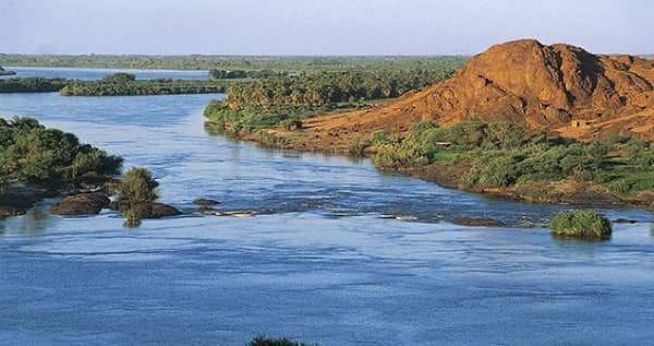
8. Congo River (Zaire River) — 4,700 km
The Congo River is Africa’s second longest river at approximately 4,700 kilometres and the world’s deepest river — with measured depths exceeding 220 metres in the Congo Canyon, depths far greater than any other river on earth. The Congo is also the world’s second largest river by discharge volume after the Amazon — its basin receiving extraordinarily heavy equatorial rainfall year-round across the Congo rainforest, which is the world’s second largest tropical rainforest after the Amazon.
The Congo River basin — covering approximately 3.7 million square kilometres — straddles the equator across Central Africa, draining portions of the Democratic Republic of Congo, Republic of Congo, Central African Republic, Zambia, Angola, Tanzania, Cameroon, and Burundi. The equatorial geography means that different parts of the basin are always in their rainy season — creating a remarkably consistent year-round water flow compared to most rivers whose discharge varies dramatically between wet and dry seasons.
The Congo’s extraordinary rapids and falls — including Livingstone Falls (a series of approximately 32 cataracts over 350 kilometres) — prevented historical navigation between the Atlantic coast and the interior, effectively isolating Central Africa from coastal trade until the colonial era. This geographical barrier simultaneously preserved one of the world’s most extraordinary concentrations of biodiversity including forest elephants, bonobos, gorillas, okapis, and thousands of endemic plant and fish species. The river’s fish fauna — over 700 species, with approximately 80% found nowhere else — is one of the world’s most remarkable examples of evolutionary isolation creating extraordinary endemic biodiversity.
Key facts — The Congo is the only major river to cross the equator twice. Stanley Pool (Malebo Pool) — a lake-like widening in the river near Kinshasa and Brazzaville — is one of the world’s most significant river features. The Congo Basin is sometimes called the “second lung of the earth” alongside the Amazon.
9. Amur-Argun River — 4,444 km
The Amur River — called Heilong Jiang (Black Dragon River) in Chinese — combined with its source tributary the Argun River measures approximately 4,444 kilometres, making it the world’s ninth longest river. The Amur-Argun system flows from its source in the Mongolian steppe through Russia’s Far East and along much of the Russia-China border before emptying into the Strait of Tartary between the Russian mainland and Sakhalin Island. For much of its course, the Amur serves as an international boundary — one of the world’s longest river borders between two nations.
The Amur basin is home to one of the world’s most remarkable concentrations of large mammals — the critically endangered Amur leopard (the world’s rarest big cat), the Amur tiger (Siberian tiger), the Far Eastern leopard cat, and brown bears all inhabit the basin’s temperate forests. The Amur is also notable for its extraordinary fish diversity — including the kaluga sturgeon, the world’s largest freshwater fish, which can reach lengths of 5.6 metres and weights of over 1,000 kilograms.
Key facts — The Amur basin has been the subject of significant territorial dispute between Russia and China throughout their history of relations. The river freezes annually from November to April. The basin contains significant untapped mineral and timber resources.
10. Lena River — 4,400 km
The Lena River is Russia’s longest river flowing entirely within its borders — at approximately 4,400 kilometres from its source in the Baikal Mountains near Lake Baikal northward through Eastern Siberia to the Laptev Sea (part of the Arctic Ocean). The Lena’s delta — approximately 32,000 square kilometres — is one of the world’s largest river deltas and one of the largest nature reserves in Russia, providing critical breeding habitat for Arctic waterfowl including millions of migratory birds that nest in the delta’s wetlands during the brief Siberian summer.
The Lena flows through the Siberian permafrost zone for much of its course — a geological context of increasing scientific significance as climate change thaws permafrost across Siberia, releasing stored carbon and methane in quantities that could significantly accelerate global warming. The river’s banks in Yakutia contain extraordinarily well-preserved mammoth remains frozen in the permafrost — the Lena basin has yielded some of the world’s most scientifically significant mammoth specimens, providing insights into Pleistocene megafauna and the climate conditions of the last ice age.
Key facts — The Lena is navigable for approximately 3,200 kilometres during the summer months. The spring breakup of the Lena’s ice — which occurs from south to north, creating massive ice jams — is one of Siberia’s most dramatic annual natural events. Yakutsk, built on permafrost, is the world’s largest city built entirely on permafrost and sits on the Lena’s banks.
Comparison of Drainage Basins
| River | Drainage Basin (km²) | Discharge (m³/s) |
| Amazon | 7,050,000 | 209,000 |
| Congo | 3,730,000 | 41,000 |
| Mississippi-Missouri | 3,220,000 | 16,800 |
| Ob-Irtysh | 2,990,000 | 12,500 |
| Nile | 2,870,000 | 2,830 |
| Yenisei-Angara | 2,580,000 | 19,600 |
| Lena | 2,490,000 | 17,100 |
| Amur-Argun | 1,855,000 | 11,400 |
| Yangtze | 1,800,000 | 30,000 |
| Yellow River | 745,000 | 1,365 |
Frequently Asked Questions (FAQs)
Q: Which is the longest river in the world?
A: The Nile River in Africa is the world’s longest river at approximately 6,650 kilometres, though the Amazon comes very close at approximately 6,400 kilometres and some measurements place the Amazon marginally ahead depending on methodology.
Q: Why is the Amazon vs Nile length debate ongoing?
A: River length measurement depends on where the source is defined and how tributaries are counted. Different scientific expeditions using different methodologies have reached different conclusions — some placing the Amazon marginally ahead of the Nile when the furthest tributaries are included.
Q: Which is the largest river by water volume?
A: The Amazon is by far the largest river by discharge volume — carrying approximately 209,000 cubic metres of water per second, more than the next seven largest rivers combined.
Q: Which is the deepest river in the world?
A: The Congo River is the world’s deepest river, with measured depths exceeding 220 metres in the Congo Canyon section.
Q: Which river flows through the most countries?
A: The Nile flows through 11 countries — the most of any river on this list. The Danube (not in the top 10 by length) flows through 10 countries.
Q: Which is the longest river in Asia?
A: The Yangtze River at 6,300 kilometres is Asia’s longest river.
Q: Which is the longest river in India?
A: The Ganga (Ganges) at approximately 2,525 kilometres is India’s longest river flowing entirely within its borders, though the Indus at approximately 3,180 kilometres is longer when its Pakistan section is included.

Brandon is the cheif editor and writer at WorldUnfolds.com. With a passion for storytelling and a keen editorial eye, he crafts engaging content that captivates and enlightens readers worldwide.