Mountain ranges are among Earth’s most enduring geological features — yet even the most permanent-seeming landscape is subject to the inexorable forces of tectonic uplift, volcanic activity, and erosion that continuously reshape the planet’s surface over geological time. The oldest mountain ranges in the world are not necessarily the tallest — in fact, the opposite is often true, as billions of years of erosion have worn ancient peaks down from potentially Himalayan heights to gentle, rounded ridges. Determining a mountain range’s age requires radiometric dating of the rocks, analysis of ancient orogenic (mountain-building) events, and understanding of the tectonic processes that created uplift. Here are the ten oldest mountain ranges in the world.
1. Barberton Greenstone Belt, South Africa (3.5 Billion Years Old)
The Barberton Greenstone Belt in Mpumalanga Province, South Africa — part of the ancient Kaapvaal Craton — represents some of the oldest exposed crustal rock on Earth, dating to approximately 3.5 billion years ago. While not technically a conventional mountain range, the Makhonjwa Mountains that form part of this belt are often cited as the world’s oldest mountains. The greenstone belt contains extraordinarily well-preserved ancient volcanic and sedimentary rocks, including pillow lavas that formed when ancient volcanic eruptions occurred beneath the ocean — evidence of the geological conditions present during Earth’s Archean Eon. Perhaps most remarkably, the Barberton belt contains some of the earliest known evidence of life on Earth — microfossils and stromatolite structures approximately 3.5 billion years old. The region was designated a UNESCO World Heritage Site in 2018.
2. Magaliesberg Range, South Africa (2.5 Billion Years Old)
The Magaliesberg in South Africa’s North West and Gauteng provinces is approximately 2.5 billion years old, formed during the Proterozoic Eon when ancient sedimentary deposits were metamorphosed and folded into ridges by the same tectonic forces that assembled the Kaapvaal Craton into one of Earth’s oldest stable continental plates. Though the Magaliesberg’s ridges today reach only modest elevations of approximately 1,800 metres above sea level, they have been continuously present as a landscape feature for a period that encompasses approximately half of Earth’s entire 4.5 billion year history. The range provides important habitat for raptors, including the black eagle, and its ancient quartzite cliffs, diverse plant life, and archaeological sites with evidence of human habitation stretching back hundreds of thousands of years make it one of South Africa’s most layered landscapes.
3. Waterberg Mountains, South Africa (2.5 Billion Years Old)
The Waterberg in Limpopo Province is another member of South Africa’s extraordinary collection of Precambrian ancient landscapes — sandstone and quartzite ridges dating to approximately 2.5 billion years ago. The Waterberg Biosphere Reserve, designated by UNESCO, encompasses the mountain range and its surrounding landscape — one of the world’s largest wildlife conservation areas outside protected national parks. The Waterberg’s ancient red sandstone landscape, with its distinctive flat-topped mesas and deep ravines, has been shaped by over two billion years of erosion. The area contains significant archaeological sites demonstrating continuous human presence across hundreds of thousands of years, connecting the ancient geological landscape to the equally ancient story of human evolution in southern Africa.
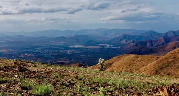
4. Aravalli Range, India (1.5–2.5 Billion Years Old)
The Aravalli Range in Rajasthan and Gujarat — stretching approximately 800 km from Gujarat to Delhi — is one of the world’s oldest fold mountain ranges, with geological evidence placing its formation between 1.5 and 2.5 billion years ago. It is considered the remnant of one of the world’s ancient continental collision zones, predating the Himalayas by over a billion years. The Aravallis today are modest in elevation — rarely exceeding 1,722 metres at Guru Shikhar, the highest point — but represent the eroded remnants of a mountain system that may once have rivalled the Himalayas in height. The range creates the critical geographic boundary between the Thar Desert to the west and the fertile Gangetic plain to the east, functioning as a natural barrier that shapes monsoon rainfall patterns and agricultural conditions across a vast region of northwestern India.
5. Appalachian Mountains, United States (480 Million Years Old)
The Appalachian Mountains of eastern North America — stretching approximately 2,400 km from Alabama to Newfoundland — were formed approximately 480 million years ago during the Taconic Orogeny, when ancient tectonic plate collisions pushed what are now North America and Europe together. At their Carboniferous peak approximately 300 million years ago, the Appalachians may have been as tall as the Himalayas — their relatively modest modern elevations (maximum approximately 2,037 metres at Mount Mitchell) reflect hundreds of millions of years of erosion. The ancient Appalachians were physically connected to the Scottish Highlands, Scandinavian Caledonides, and the Atlas Mountains of Morocco before the breakup of Pangaea — a geological family connection that explains the remarkable similarities between plant species in the Appalachians and eastern Asia (another fragment of the same ancient supercontinent).
6. Caledonian Mountains, Scotland and Norway (490 Million Years Old)
The Caledonian Mountain system — encompassing the Scottish Highlands, Scandinavian mountains (Kjølen), the mountains of Greenland, and the Appalachians of North America — forms a single ancient mountain system that was created by the collision of Laurentia (North America) and Baltica (Northern Europe) approximately 490–390 million years ago. The Scottish Highlands represent one of the most ancient landscapes in the British Isles, with Precambrian Lewisian Gneiss on the northwest coast of Scotland — at approximately 3 billion years old — being some of the oldest exposed rock in the British Isles. The Caledonians were once enormous — similar in scale to the modern Himalayas — and have been reduced by hundreds of millions of years of erosion to the relatively gentle but extraordinarily scenic highlands that define Scotland’s romantic landscape.
7. Grampian Mountains, Scotland (490 Million Years Old)
The Grampian Mountains in central and eastern Scotland are part of the broader Caledonian mountain system, formed during the same Caledonian Orogeny approximately 490 million years ago. Ben Nevis — at 1,345 metres the highest peak in the British Isles — is a Grampian massif composed of ancient granite that solidified from underground magma approximately 400 million years ago. The distinctive U-shaped glacial valleys, ribbon lakes (lochs), and rounded summit plateaux of the Grampians reflect the combined work of hundreds of millions of years of erosion and the more recent intensive glaciation during the Ice Ages. The Cairngorms — a subrange of the Grampians — constitute a high plateau landscape of Arctic-alpine character unique in the British Isles, supporting rare species including the ptarmigan, snow bunting, and Scottish crossbill.
8. Ural Mountains, Russia (300–340 Million Years Old)
The Ural Mountains — stretching approximately 2,500 km from the Arctic Ocean to Kazakhstan — were formed during the Uralian Orogeny between approximately 300 and 340 million years ago through the collision of the ancient Laurussian and Kazakhstania tectonic plates. The Urals are geographically significant as the conventional boundary between Europe and Asia — the mountain range marks the eastern limit of the European continent, making it one of the world’s most geopolitically important natural features. Like the Appalachians (formed in the same general geological period by related plate collision processes on the other side of the Pangaean supercontinent), the Urals have been substantially eroded from their original Himalayan-scale heights to modest elevations rarely exceeding 1,900 metres. The Urals are exceptionally mineral-rich — containing vast deposits of iron ore, copper, platinum, gold, and precious stones that have driven Russian industrial development for centuries.
9. Atlas Mountains, North Africa (300 Million Years Old)
The Atlas Mountains — stretching approximately 2,500 km across Morocco, Algeria, and Tunisia — were formed through multiple orogenic phases, with initial formation approximately 300 million years ago and subsequent uplift during the Alpine Orogeny that also created the Alps and Pyrenees approximately 50–66 million years ago. The High Atlas contains North Africa’s highest peak, Toubkal (4,167 metres), making it the Maghreb’s most dramatic landscape. The Atlas Mountains create the critical geographic barrier between the Mediterranean climate of North Africa’s coast and the Sahara Desert to the south — their role in rain shadow effects and moisture capture shapes the climate of a vast region. The Atlas was physically connected to the Appalachians when Africa and North America formed part of the Pangaean supercontinent, and their geological similarities testify to this ancient continental family connection.
10. Himalayan Mountains, Asia (50 Million Years Old)
The Himalayan range — the world’s tallest, containing all 14 peaks above 8,000 metres including Mount Everest at 8,849 metres — is geologically the youngest major mountain range on this list, having begun forming approximately 50 million years ago when the Indian subcontinent collided with the Eurasian plate. Though the youngest, the Himalayas’ significance justifies their inclusion — they are the world’s most dramatically active mountain-building zone, still rising at approximately 5mm per year as the Indian plate continues pushing northward. The Himalayas influence the climate of the entire Asian continent — creating the monsoon system that provides water for billions of people, blocking Arctic air from South Asia, and feeding the great rivers (Ganges, Indus, Yangtze, Mekong) that sustain Asian civilisation. The range will continue growing for millions of years into the future.
Conclusion
These ten mountain ranges span nearly the entire history of Earth’s solid crust — from the 3.5-billion-year-old Barberton Greenstone Belt to the geologically youthful Himalayas. Together they trace the history of plate tectonics, continental drift, and the continuous reshaping of Earth’s surface that demonstrates our planet’s most fundamental dynamism. Mountains remind us that even the most permanent-seeming features of our world are temporary expressions of forces operating on timescales that humble human imagination.

Brandon is the cheif editor and writer at WorldUnfolds.com. With a passion for storytelling and a keen editorial eye, he crafts engaging content that captivates and enlightens readers worldwide.